.png)


 Return
|
Ref ID: 1N2017/2702 | Posted On: 08-06-2017 | Updated on: 16-11-2017
|
|
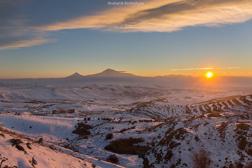
Mount Ararat
Mount Ararat (/ˈærəˌræt/ ARR-ə-rat;[8] Turkish: Ağrı Dağı; Armenian: Մասիս, Masis and Արարատ, Ararat) is a snow-capped and dormant compound volcano in the extreme east of Turkey.[9] It consists of two major volcanic cones: Greater Ararat, the highest peak in Turkey and the Armenian plateau with an elevation of 5,137 m (16,854 ft); and Little Ararat, with an elevation of 3,896 m (12,782 ft).[10] The Ararat massif is about 40 km (25 mi) in diameter.
Despite the scholarly consensus that the "mountains of Ararat" of the Book of Genesis do not refer to specifically Mt. Ararat, it has been widely accepted in Christianity as the resting place of Noah's Ark. It is the principal national symbol of Armenia and has been considered a sacred mountain by Armenians. It is featured prominently in Armenian literature and art and is an icon for Armenian irredentism. Along with Noah's Ark, it is depicted on the coat of arms of Armenia.
The first efforts to reach Ararat's summit were made in the Middle Ages. However, it was not until 1829 when Friedrich Parrot and Khachatur Abovian, accompanied by four others, made the first recorded ascent.[11]
Political borders
Mount Ararat forms a near-quadripoint between Turkey, Armenia, Azerbaijan and Iran. Its summit is located some 16 km (10 mi) west of both the Iranian border and the border of the Nakhchivan exclave of Azerbaijan, and 32 km (20 mi) south of the Armenian border. The Turkish–Armenian–Azerbaijani and Turkish–Iranian–Azerbaijani tripoints are some 8 km apart, separated by a narrow strip of Turkish territory containing the E99 road which enters Nakhchivan at 39.6553°N 44.8034°E.
From the 16th century until 1828 Great Ararat's summit and the northern slopes, along with the eastern slopes of Little Ararat were part of Persia, while the range was part of the Ottoman-Persian border. Following the 1826–28 Russo-Persian War and the Treaty of Turkmenchay, the Persian controlled territory was ceded to the Russian Empire. Little Ararat became the point where the Turkish, Persian, and Russian imperial frontiers converged.[12] The current international boundaries were formed throughout the 20th century. The mountain came under Turkish control during the 1920 Turkish–Armenian War.[13] It formally became part of Turkey according to the 1921 Treaty of Moscow and Treaty of Kars.[14] In the late 1920s, Turkey crossed the Iranian border and occupied the eastern flank of Lesser Ararat as part of its effort to quash the Kurdish Ararat rebellion.[15] The Kurdish rebels were using the area "as a haven against the state in their uprising."[16] Iran eventually agreed to cede the area to Turkey in a territorial exchange.[15][17] The Iran-Turkey boundary skirts east of Lesser Ararat, the lower peak of the Ararat massif.
Names and etymology

View from the Araratian plain near the city of Artashat, Armenia.
Closeup of Greater Ararat

Closeup of Lesser Ararat

View from Turkey
Ararat (Hebrew: אֲרָרָט;[18] Armenian: Արարատ, Ararat; Western Armenian: Ararad) is the Hebrew spelling of Urartu,[19][b] a kingdom that existed in the Armenian plateau in the 9th-6th centuries BC. The mountain is known as Ararat in European languages.[21][22] However, none of the native peoples have traditionally referred to the mountain by that name.[23]
The traditional Armenian name is Masis (Մասիս [maˈsis]), which is sometimes transliterated as Massis.[24][23] However, nowadays, the terms Masis and Ararat are both widely, often interchangeably, used in Armenian.[25] The peaks are referred to in plural as Մասիսներ Masisner.[26] Greater Ararat is known as simply Masis or Մեծ Մասիս (Mets Masis, "Great/Big Masis"). While Lesser Ararat is known as Sis (Սիս)[27][28] or Փոքր Մասիս (P′ok′r Masis, "Little/Small Masis").[21][26] The folk etymology expressed in Movses Khorenatsi's History of Armenia derives the name from king Amasya, the great-grandson of the legendary Armenian patriarch Hayk, who is said to have called the mountain Masis after himself.[29][30] While according to Sebeos it comes from the personal name Marseak.[29] According to Russian orientalist Anatoly Novoseltsev the word Masis derives from Middle Persian masist, "the largest."[31] According to Armenian historian Sargis Petrosyan the mas root in Masis means "mountain", cf. Proto-Indo-European *mņs-.[30]
In classical antiquity, particularly in Strabo's Geographica, the peaks of Ararat were known in Greek as Ἄβος (Abos) and Νίβαρος (Nibaros).[c]
The Turkish name is Ağrı Dağı [ɑːrɯ dɑ.ɯ], Ottoman Turkish: اغـر طﺎﻍ Ağır Dağ), i.e. "Mountain of Ağrı". Ağrı literally translates to "pain" or "sorrow".[21][31][36][37] This name has been known since the late Middle Ages.[31]
The traditional Persian name is کوه نوح, [ˈkuːhe ˈnuːh], Kūh-e Nūḥ,[12] literally the "mountain of Noah".[21][24]
The Kurdish name of the mountain is çiyayê Agirî[38][39] [t͡ʃɪjaːˈje aːgɪˈriː], which translates to "fiery mountain".[40]
Geography
Mount Ararat is located in the Eastern Anatolia Region of Turkey between the provinces of Ağrı and Iğdır, near the border with Iran, Armenia and Nakhchivan exclave of Azerbaijan, between the Aras and Murat rivers.[4] Its summit is located some 16 km (10 mi) west of the Turkey-Iran border and 32 km (20 mi) south of the Turco-Armenian border. The Ararat plain runs along its northwest to western side.
Elevation
An elevation of 5,165 m (16,946 ft) for Mount Ararat is still given by some authorities. However, a number of other sources, such as public domain and verifiable Shuttle Radar Topography Mission (STRM) data[41] and a 2007 GPS measurement[42] show that the alternatively widespread figure of 5,137 m (16,854 ft) is probably more accurate, and that the current elevation may be even lower due to the melting of its snow-covered ice cap. 5,137 m is also supported by numerous topographic maps.[43]
Summit Ice Cap
Mount Ararat has an ice cap on its summit. Since at least about 1957, it has been shrinking. In the late 1950s, Blumenthal[44] observed that there existed 11 outlet glaciers emerging from a summit snow mass that covered about 10 km2 (3.9 sq mi). At that time, it was found that the present glaciers on the summit of Ararat to extend as low as an elevation of 3,900 meters (12,800 ft) on the north-facing slope, and an elevation of 4,200 meters (13,800 ft) on its south-facing slope.[44] Using pre-existing aerial imagery and remote sensing data, Sarıkaya[38][45] and others studied the extent of the ice cap on Mount Ararat between 1976 and 2011. They discovered that this ice cap had shrunk to 8.0 km2 (3.1 sq mi) by 1976 and to 5.7 km2 (2.2 sq mi) by 2011. They calculated that between 1976 and 2011, the ice cap on top of Mount Ararat had lost 29% of its total area at an average rate of ice loss of 0.07 km2 (0.027 sq mi) per year over 35 years. This rate is consistent with the general rates of retreat of other Turkish summit glaciers and ice caps that have been documented by other studies.[45]
Blumenthal[44] estimated that the snow line had been as low as 3,000 meters (9,800 ft) in elevation during the Late Pleistocene. Such a snow line would have created an ice cap of 100 km2 (39 sq mi) in extent. However, he observed a lack of any clear evidence of prehistoric moraines other than those which were close to the 1958 glacier tongues. Blumenthal explained the absence of such moraines by the lack of confining ridges to control glaciers, insufficient debris load in the ice to form moraines, and their burial by later eruptions. Years later, Birman[46] observed on the south-facing slopes a possible moraine that extends at least 300 meters (980 ft) in altitude below the base of the 1958 ice cap at an elevation of 4,200 meters (13,800 ft). He also found two morainal deposits that were created by a Mount Ararat valley glacier of Pleistocene, possibly Wisconsinan (Last Glacial Maximum) age downvalley from Lake Balik Golu. The higher moraine lies at an altitude of about 2,200 meters (7,200 ft) and the lower moraine lies at an altitude of about 1,800 meters (5,900 ft). The lower moraine occurs about 15 kilometers (9.3 mi) downstream from Lake Balik Golu. Both moraines are about 30 meters (98 ft) high. It is suspected that Lake Balik Golu occupies a glacial basin.[46]

Geology
Mount Ararat is a polygenic, compound stratovolcano. Covering an area of 1,100 km2 (420 sq mi), it is the largest volcanic edifice within the region. Along its northwest–southeast trending long axis, Mount Ararat is about 45 kilometers (28 mi) long and is about 30 kilometers (19 mi) long along its short axis. It consists of about 1,150 km3 (280 cu mi) of dacitic and rhyolitic pyroclastic debris and dacitic, rhyolitic, and basaltic lavas.[10]
Mount Ararat consists of two distinct volcanic cones, Greater Ararat and Lesser Ararat (Little Ararat). The western volcanic cone, Greater Ararat, is a steep-sided volcanic cone that is larger and higher than the eastern volcanic cone. Greater Ararat is about 25 kilometers (16 mi) wide at the base and rises about 3 kilometers (1.9 mi) above the adjacent floors of the Iğdir and Doğubeyazıt basins. The eastern volcanic cone, Lesser Ararat, is 3,896 meters (12,782 ft) high and 15 kilometers (9.3 mi) across. These volcanic cones, which lie 13 kilometers (8.1 mi) apart, are separated by a wide north–south-trending crack. This crack is the surface expression of an extensional fault. Numerous parasitic cones and lava domes have been built by flank eruptions along this fault and on the flanks of both of the main volcanic cones.[10]
Mount Ararat lies within a complex, sinistral pull-apart basin that originally was a single, continuous depression. The growth of Mount Ararat partitioned this depression into two smaller basins, the Iğdir and Doğubeyazıt basins. This pull-apart basin is the result of strike-slip movement along two en-echelon fault segments, the Doğubeyazıt–Gürbulak and Iğdir faults, of a sinistral strike–slip fault system. Tension between these faults, not only formed the original pull-apart basin, but created a system of faults, exhibiting a horsetail splay pattern, that control the position of the principal volcanic eruption centers of Mount Ararat and associated linear belt of parasitic volcanic cones. The strike-slip fault system within which Mount Ararat located is the result of north–south convergence and tectonic compression between the Arabian Platform and Laurasia that continued after the Tethys Ocean closed during the Eocene epoch along the Bitlis–Zagros suture.[10][47][48]
Geological history
During the early Eocene and early Miocene, the collision of the Arabian platform with Laurasia closed and eliminated the Tethys Ocean from the area of what is now Anatolia. The closure of these masses of continental crust, collapsed this ocean basin by middle Eocene and resulted in a progressive shallowing of the remnant seas, until the end of the early Miocene. Post-collisional tectonic convergence within the collision zone resulted in the total elimination of the remaining seas from East Anatolia, at the end of early Miocene, crustal shortening and thickening across the collision zone, and uplift of the East Anatolian–Iranian plateau. Accompanying this uplift was extensive deformation by faulting and folding, which resulted in the creation of numerous local basins. The north–south compressional deformation continues today as evidenced by ongoing faulting, volcanism, and seismicity.[10][47][49]
Within Anatolia, regional volcanism started middle-late Miocene. During the late Miocene–Pliocene period, widespread volcanism blanketed the entire East Anatolian–Iranian plateau under thick volcanic rocks. This volcanic activity has continued uninterrupted until historical times. Apparently, it reached a climax during the latest Miocene–Pliocene, 6 to 3 Ma. During the Quaternary, the volcanism became restricted to a few local volcanoes such as Mount Ararat. These volcanoes are typically associated with north–south tensional fractures formed by the continuing the north–south shortening deformation of Anatolia.[10]
In their detailed study and summary of the Quaternary volcanism of Anatolia, Yilmaz[10] and others recognized four phases to the construction of Mount Ararat from volcanic rocks exposed in glacial valleys deeply carved into it flanks. First, they recognized a fissure eruption phase of Plinian-subPlinian fissure eruptions that deposited more than 700 meters (2,300 ft) of pyroclastic rocks and a few basaltic lava flows. These volcanic rocks were erupted from approximately north northwest–south southeast-trending extensional faults and fissures prior to the development of Mount Ararat. Second, a cone-building phase began when the volcanic activity became localized at a point along a fissure. During this phase, the eruption of successive flows of lava up to 150 meters (490 ft) thick and pyroclastic flows of andesite and dacite composition and later eruption of basaltic lava flows, formed the Greater Ararat cone with a low conical profile. Third, during a climatic phase, copious flows of andesitic and basaltic lavas were erupted. During this phase, the current cones of Greater and Lesser Ararat were formed as eruptions along subsidiary fissures and cracks and flank occurred. Finally, the volcanic eruptions at Mount Ararat transitioned into a flank eruption phase during which a major north–south-trending fault offset the two cones developed along with a number of subsidiary fissures and cracks on the volcano's flanks. Along this fault and the subsidiary fissures and cracks, a number of parasitic cones and domes were built by minor eruptions. One subsidiary cone erupted voluminous basalt and andesite lava flows. They flowed across the Doğubeyazıt plain and along the southerly flowing Sarısu River. These lava flows formed black ʻaʻā and pāhoehoe lava flows that contain well preserved lava tubes.[10] The radiometric dating of these lava flows yielded radiometric ages of 0.4, 0.48 and 0.81 Ma.[50] Overall, radiometric ages obtained from the volcanic rocks erupted by Mount Ararat range from 1.5 to 0.02 Ma.[10]
Recent volcanic and seismic activity
The chronology of Holocene volcanic activity associated with Mount Ararat is poorly documented. However, either archaeological excavations, oral history, historical records, or a combination of these data provide evidence that volcanic eruptions of Mount Ararat occurred in 2500–2400 BC, 550 BC, possibly in 1450 AD and 1783 AD, and definitely in 1840 AD. Archaeological evidence demonstrates that explosive eruptions and pyroclastic flows from the northwest flank of Mount Ararat destroyed and buried at least one Kura–Araxes culture settlement and caused numerous fatalities in 2500–2400 BC. Oral histories indicated that a significant eruption of uncertain magnitude occurred in 550 BC and minor eruptions of uncertain nature might have occurred in 1450 AD and 1783 AD.[5][48][49][51] According to the interpretation of historical and archaeological data, strong earthquakes not associated with volcanic eruptions also occurred the area of Mount Ararat in 139, 368, 851–893, and 1319 AD. During the 139 AD earthquake, a large landslide that caused many casualties and was similar to the 1840 AD landslide originated from the summit of Mount Ararat.[48][49][52]
1840 eruption
Historical records and oral history document a phreatic eruption and pyroclastic flow from radial fissures on the upper north flank of Mount Ararat and a possibly associated earthquake of magnitude 7.4 that caused severe damage and numerous casualties in 1840 AD. Up to 10,000 people in the Mount Ararart region died in the earthquake, including 1,900 villagers in the village of Akhuri (modern Yenidoğan) who were killed by a gigantic landslide and subsequent debris flow. In addition, this combination of landslide and debris flow destroyed the town of Aralik, several villages, and Russian military barracks. It also temporarily dammed the Sevjour River.[5][48][49][51]
Ascents
The 13th century missionary William of Rubruck wrote that "Many have tried to climb it, but none has been able."[53] 18th century English theologian Thomas Stackhouse noted that "All the Armenians are firmly persuaded that Noah's ark exists to the present day on the summit of Mount Ararat, and that in order to preserve it, no person is permitted to approach it."[54] In response to its first ascent by Parrot and Abovian, one high-ranking Armenian Apostolic Church clergyman commented that to climb the sacred mountain was "to tie the womb of the mother of all mankind in a dragonish mode." By contrast, in the 21st century to climb Ararat is "the most highly valued goal of some of the patriotic pilgrimages that are organized in growing number from Armenia and the Armenian diaspora."[55]
First ascent

Friedrich Parrot
Khachatur Abovian
The first recorded ascent of the mountain in the modern times took place on 9 October [O.S. 27 September] 1829.[11][56][57][58] The Baltic German naturalist Friedrich Parrot of the University of Dorpat arrived at Etchmiadzin in mid-September 1829, almost two years after Russian capture of Erivan, for the single purpose of exploring Ararat.[59] The prominent Armenian writer Khachatur Abovian, then a deacon and translator at Etchmiadzin, was assigned by Catholicos Yeprem, the head of the Armenian Church, as interpreter and guide.
Parrot and Abovian crossed the Aras River into the district of Surmali and headed to the Armenian village of Akhuri situated on the northern slope of Ararat 1,220 metres (4,000 ft) above sea level. They set up a base camp at the Armenian monastery of St. Hakob some 730 metres (2,400 ft) higher, at an elevation of 1,943 metres (6,375 ft). After two failed attempts, they reached the summit on their third attempt at 3:15 p.m. on October 9, 1829.[56][60] The group included Parrot, Abovian, two Russian soldiers—Aleksei Zdorovenko and Matvei Chalpanov, and two Armenian Akhuri villagers—Hovhannes Aivazian and Murad Poghosian.[61] Parrot measured the elevation at 5,250 metres (17,220 ft) using a mercury barometer. This was not only the first ascent of Ararat, but also the second highest elevation climbed by man up to that date outside of Mount Licancabur in the Chilean Andes. Abovian dug a hole in the ice and erected a wooden cross facing north.[62] Abovian also picked up a chunk of ice from the summit and carried it down with him in a bottle, considering the water holy. On 8 November [O.S. 27 October] 1829, Parrot and Abovian together with the Akhuri hunter Sahak’s brother Hako, acting as a guide climbed up Lesser Ararat.[63]
Later notable ascent
Other early notable climbers of Ararat included Russian climatologist and meteorologist Kozma Spassky-Avtonomov (August 1834), Karl Behrens (1835), German mineralogist and geologist Otto Wilhelm Hermann von Abich (29 July 1845),[64] British politician Henry Danby Seymour (1848).[65] Later in the 19th century, two British scholars on Armenia—James Bryce (1876)[66] and H. F. B. Lynch (1893)[67][68] climbed the mountain. The first winter climb was by Bozkurt Ergör, the former president of the Turkish Mountaineering Federation, who climbed on 21 February 1970.[69]
Resting place of Noah's Ark

Topography of Paradise by Jesuit scholar and polymath Athanasius Kircher as pictured in his book Arca Noë (1675). In the northeast, in the mountains above Armenia stands Mount Ararat, shown with a rectangular-shaped ark on the summit.[70]
Origins of the tradition
According to the fourth verse of the eighth chapter of the Book of Genesis (Genesis 8:4), following a flood, Noah's Ark landed on the "mountains of Ararat" (Biblical Hebrew: הָרֵי אֲרָרָט, hare ararat).[71] Most historians and Bible scholars agree that "Ararat" is the Hebrew name of Urartu, the geographic predecessor of Armenia and referred to the wider region at the time and not the mountain today known as Ararat.[d] Indeed, the phrase is translated as "mountains of Armenia" (montes Armeniae) in the Vulgate, the fourth century Latin translation of the Bible.[75] Nevertheless, Mount Ararat is considered the traditional site of the resting place of Noah's Ark and most Christians prefer this view "largely because it would have been the first peak to emerge from the receding flood waters."[76] It has therefore been called a biblical mountain.[77][78]
Mount Ararat has been associated with the Genesis flood story since the 11-12th centuries.[73] The local Armenian population began to identify it as the ark's landing place during those centuries.[79] F. C. Conybeare wrote that the mountain was "a center and focus of pagan myths and cults [...] and it was only in the eleventh century, after these had vanished from the popular mind, that the Armenian theologians ventured to locate on its eternal snows the resting-place of Noah's ark."[80] The 13th century Franciscan missionary William of Rubruck is usually considered the earliest reference for the tradition of Mount Ararat as the landing place of the ark in European literature.[53][72][81] The 14th century English traveler John Mandeville is another early author who mentioned Mount Ararat, "where Noah's ship rested, and it is still there."[82][83]
Prevalence of the legend

Descent of Noah from Ararat by Ivan Aivazovsky (1889, National Gallery of Armenia) depicts Noah with his family, and a procession of animals, crossing the Ararat plain, following their descent from Mount Ararat, shown in the background.[84][85]
Most Christians identify Mount Ararat with the biblical "mountains of Ararat," despite the fact that six other landing places have been proposed.[76] Ararat is where the European tradition and most of Western Christianity place the landing of Noah's Ark. According to Spencer and Lienard the tradition "seems to be well entrenched in the Christian world."[81][e] During his visit to Armenia in 2001 Pope John Paul II declared in his homily in Yerevan's St. Gregory the Illuminator Cathedral: "We are close to Mount Ararat, where tradition says that the Ark of Noah came to rest."[89] Patriarch Kirill of Moscow, the head of the Russian Orthodox Church, also mentioned Mount Ararat as the resting place of Noah's Ark in his speech at the Etchmiadzin Cathedral during his visit to Armenia in 2010.[90]
James Bryce, while admitting that the biblical passage implies that the ark rested upon a "mountain in the district which the Hebrews knew as Ararat, or Armenia", wrote in an 1878 article that the biblical writer must have had Mt. Ararat in mind because it is so "very much higher, more conspicuous, and more majestic than any other summit in Armenia."[66] Those critical of this view point out that Ararat was the name of the country, not the mountain, at the time when Genesis was written. Arnold wrote in his 2008 Genesis commentary, "The location 'on the mountains' of Ararat indicates not a specific mountain by that name, but rather the mountainous region of the land of Ararat."[19]
Searches
Searches for Noah's Ark have traditionally concentrated on Mount Ararat.[76] Augustin Calmet wrote in his 1722 biblical dictionary, "It is affirmed, but without proof, that there are still remains of Noah's ark on the top of this mountain; but M. de Tournefort, who visited this spot, has assured us there was nothing like it; that the top of mount Ararat is inaccessible, both by reason of its great height, and of the snow which perpetually covers it."[86] Despite numerous reports of ark sightings (e.g. Ararat anomaly) and rumors, "no scientific evidence of the ark has emerged."[91] Searches for Noah's Ark are considered by scholars an example of pseudoarchaeology.[92][93] Kenneth Feder writes, "As the flood story itself is unsupported by any archaeological evidence, it is not surprising that there is no archaeological evidence for the existence of an impossibly large boat dating to 5,000 years ago."[94]
Significance among Armenians
Symbolism

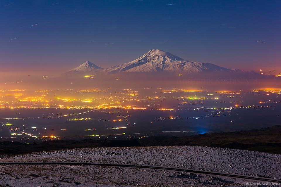
Ararat—located some 65 km (40 mi) south of the city–dominates the skyline of Armenia's capital Yerevan.

Hayk, the legendary founding father of the Armenian people, as depicted by Mkrtum Hovnatanian (1779-1846). Ararat is pictured in the background.
Despite lying outside the borders of the modern Republic of Armenia, Ararat has historically been associated with Armenia.[97][98][99][f] It is widely considered the country's principal national symbol and brand.[102][103] The image of Ararat, usually framed within a nationalizing discourse, is ubiquitous in everyday material culture in Armenia.[104] According to ethnographer Tsypylma Darieva Armenians have "a sense of possession of Ararat in the sense of symbolic cultural property."[105]
Ararat is known as the "holy mountain" of the Armenian people.[106][95][107] It was principal to the pre-Christian Armenian mythology, where it was the home of the gods.[108] With the rise of Christianity, the mythology associated with pagan worship of the mountain was lost.[109] Ararat was the geographical center of ancient Armenian kingdoms.[g] One scholar defined the historic Greater Armenia (Major Armenia) as "the area about 200 miles [320 km] in every direction from Mount Ararat."[113] In 19th-century era of romantic nationalism, when an Armenian state did not exist, Mt. Ararat symbolized the historical Armenian nation-state.[114] The First Republic of Armenia, the first modern Armenian state that existed between 1918 and 1920, was sometimes called the Araratian Republic or the Republic of Ararat as it was centered in the Ararat plain.[115]
Myth of origin
The Genesis flood narrative was linked to the Armenian myth of origin by the early medieval historian Movses Khorenatsi. In his History of Armenia, he wrote that Noah and his family first settled in Armenia and later moved to Babylon. Hayk, a descendant of Japheth, a son of Noah, revolted against Bel and returned to the area around Mount Ararat, where established the roots of the Armenian nation. He is thus considered the legendary founding father and the name giver of the Armenian people.[116][117] According to Razmik Panossian, this legend "makes Armenia the cradle of all civilisation since Noah's Ark landed on the 'Armenian' mountain of Ararat. […] it connects Armenians to the biblical narrative of human development. […] it makes Mount Ararat the national symbol of all Armenians, and the territory around it the Armenian homeland from time immemorial."[118]
Symbol of genocide and Western Armenia
In the aftermath of the Armenian Genocide of 1915, a large portion of the Armenian homeland, particularly what is now eastern Turkey, was left with little to no Armenian population. Although Ararat was then part of the Russian Empire's Erivan Governorate and was ceded to Turkey by the 1921 Treaty of Kars, it came to represent the loss of Western Armenia (eastern Turkey) in the national consciousness of the Armenians.[h][120][121] Ari L. Goldman noted in 1988, "In most Armenian homes in the modern diaspora, there are pictures of Mount Ararat, a bittersweet reminder of the homeland and national aspirations."[122] Ararat has become a symbol of Armenian efforts to reclaim its "lost lands", i.e. the areas west of Ararat that are now part of Turkey that had significant Armenian population before the genocide.[123] Adriaans wrote, "In everyday banal irredentism we can see that mount Ararat, indeed, features as a sanctified territory for the Armenians, following in the footsteps of the Ark of Noah, its image providing an imaginary link to a golden past."[124] Stephanie Platz wrote, "Omnipresent, the vision of Ararat rising above Yerevan and its outskirts constantly reminds Armenians of their putative ethnogenesis … and of their exile from Eastern Anatolia after the Armenian genocide of 1915."
Coat of arms of Armenia
Mount Ararat has been depicted on the coat of arms of Armenia consistently since 1918. The First Republic's coat of arms was designed by architect Alexander Tamanian and painter Hakob Kojoyan. This coat of arms was readopted by the legislature of the Republic of Armenia on April 19, 1992, after Armenia regained independence. Ararat is depicted along with the ark on its peak on the shield on an orange background.[126]
The emblem of the Armenian Soviet Socialist Republic (Soviet Armenia) was created by the painters Martiros Saryan and Hakob Kojoyan in 1921.[127] Mount Ararat is depicted in the center and makes up a large portion of it.


Current Republic (1992–)
Territorial claims

Lebanese Armenians protesting Turkish Prime Minister Erdoğan's visit to Beirut in November 2010.[129] The poster reads "Ararat is and remains Armenian".
Ararat has been described as a critical piece of the Armenian homeland.[130] The nationalist party Armenian Revolutionary Federation (Dashnaktsutyun) claims eastern Turkey (Western Armenia) as part of what it considers United Armenia.[131] The Armenian government has not made official claims to any Turkish territory,[132][133] however the Armenian government has avoided "an explicit and formal recognition of the existing Turkish-Armenian border."[134] According to Turkish political scientist Bayram Balci, regular references to the Armenian Genocide and Mount Ararat "clearly indicates" that the border with Turkey is contested in Armenia.[132]
In a 2010 interview with Der Spiegel, Armenian President Serzh Sargsyan was asked: "You can see Mount Ararat, Armenia's national symbol, from the windows of your residence. Today, the mountain is inaccessible, on the other side of the Turkish border. Turkey fears demands for land and compensation. Do you want Mount Ararat back?" Sargsyan, in response, said:[135]
No one can take Mount Ararat from us; we keep it in our hearts. Wherever Armenians live in the world today, you will find a picture of Mount Ararat in their homes. And I feel certain that a time will come when Mount Ararat is no longer a symbol of the separation between our peoples, but an emblem of understanding. But let me make this clear: Never has a representative of Armenia made territorial demands. Turkey alleges this—perhaps out of its own bad conscience?
In various settings, several notable individuals such as German historian Tessa Hofmann,[i] Slovak conservative politician František Mikloško,[j] Lithuanian political scientist and Soviet dissident Aleksandras Štromas[k] have spoken in support of Armenian claims over Mt. Ararat.
Cultural depictions

The first stamps issued by independent Armenia in 1992
Ethnographer Levon Abrahamian noted that Ararat is visually present for Armenians in reality (it can be seen from many houses in Yerevan and settlements in the Ararat plain), symbolically (through many visual representations, such as on Armenia's coats of arms), and culturally—in numerous and various nostalgic poetical, political, architectural representation.[140] The first three postage stamps issued by Armenia in 1992 after achieving independence from the Soviet Union depicted Mt. Ararat.
Mount Ararat has been depicted on various Armenian dram banknotes issued in 1993-2001; on the reverse of the 10 dram banknotes issued in 1993, on the reverse of the 50 dram banknotes issued in 1998, on the obverse of the 100 and 500 dram banknotes issued in 1993, and on the reverse of the 50,000 dram banknotes issued in 2001. It was also depicted on the reverse of the Turkish 100 lira banknotes of 1972-1986.[l]
Ararat is depicted on the logos of two of Armenia's leading universities—the Yerevan State University and the American University of Armenia. It is depicted on the logos of Football Club Ararat Yerevan (since the Soviet times) and the Football Federation of Armenia. The logo of Armavia, Armenia's now defunct flag carrier, also depicted Ararat. The publications of the Social Democrat Hunchakian Party in Lebanon (Ararad daily) and California, U.S. (Massis weekly) are both named for Ararat.
In visual art
European
Ararat was depicted in the books of European, including many British, and American travelers in the 18th-19th centuries who visited Armenia.

Joseph Pitton de Tournefort, 1718

Robert Ker Porter, 1821

"View of Ararat and the Monastery of Echmiadzin", from the 1846 English translation of Friedrich Parrot's Journey to Ararat

James Bryce, 1877

H. F. B. Lynch, 1901
Armenian
According to one source, the first Armenian artist to depict the mountain was Ivan Aivazovsky,[141] who created a painting of Ararat during his visit to Armenia in 1868.[142] Other major Armenians artists who painted Ararat include Yeghishe Tadevosyan, Gevorg Bashinjaghian, Martiros Saryan,[143] and Panos Terlemezian.

Ivan Aivazovsky, Valley of Mount Ararat, 1882

Yeghishe Tadevosyan, Ararat from Ejmiatsin, 1895

Gevorg Bashinjaghian, 1912

Panos Terlemezian, 1929
In literature
Rouben Paul Adalian suggested that "there is probably more poetry written about Mount Ararat than any other mountain on earth."[109] Travel writer Rick Antonson described Ararat as the "most fabled mountain in the world."[144]

The Russian poet Aleksandr Pushkin wrote about Ararat in his Journey to Arzrum.
Non-Armenian
English Romantic poet William Wordsworth imagines seeing the ark[145] in the poem "Sky-Prospect": Lo! in the burning west, the craggy nape/ Of a proud Ararat! and thereupon, / The Ark, her melancholy voyage done![146]
In his Journey to Arzrum (Путешествие в Арзрум; 1835–36), the celebrated Russian poet Aleksandr Pushkin recounted his travels to the Caucasus and Armenia at the time of the Russo-Turkish War (1828–29). He wrote the following about his encounter with Mount Ararat:
I went out of the tent into the fresh morning air. The sun was rising. Against the clear sky one could see a white-snowcapped, twin-peaked mountain. 'What mountain is that?' I asked, stretching myself, and heard the answer: 'That's Ararat.' What a powerful effect a few syllables can have! Avidly I looked at the Biblical mountain, saw the ark moored to its peak with the hope of regeneration and life, saw both the raven and dove, flying forth, the symbols of punishment and reconciliation...[147]
Russian Symbolist poet Valery Bryusov often referred to Ararat in his poetry and dedicated two poems to the mountain,[m] which were published in 1917. Bryusov saw Ararat as the embodiment of antiquity of the Armenian people and their culture.[148]
Russian poet Osip Mandelstam wrote fondly of Ararat during his travels in Armenia. "I have cultivated in myself a sixth sense, an 'Ararat' sense," the poet wrote, "the sense of an attraction to a mountain."[149]
During his travels to Armenia, Soviet Russian writer Vasily Grossman observed Mount Ararat from Yerevan standing "high in the blue sky." He wrote that "with its gentle, tender contours, it seems to grow not out of the earth but out of the sky, as if it has condensed from its white clouds and its deep blue. It is this snowy mountain, this bluish-white sunlit mountain that shone in the eyes of those who wrote the Bible."[150]
In The Maximus Poems American poet Charles Olson, who grew up near the Armenian neighborhood in Worcester, Massachusetts, compares the Ararat Hill near his childhood home to the mountain and "imagines he can capture an Armenian's immigrant perspective: the view of Ararat Hill as Mount Ararat."[151]
Armenian
Mt. Ararat is featured prominently in Armenian literature. According to Meliné Karakashian, Armenian poets "attribute to it symbolic meanings of unity, freedom, and independence."[152] According to Bardakjian, Ararat "epitomizes Armenia and Armenian suffering and aspirations, especially the consequences of the 1915 genocide: almost total annihilation, loss of a unique culture and land [...] and an implicit determination never to recognize the new political borders."[153]
The last two lines of Yeghishe Charents's 1920 poem "I Love My Armenia" (Ես իմ անուշ Հայաստանի) read: "And in the entire world you will not find a mountaintop like Ararat's. / Like an unreachable peak of glory I love my Mount Masis."[154]
In a 1926[155] poem dedicated to the mountain Avetik Isahakyan wrote: "Ages as though in second came, / Touched the grey crest of Ararat, / And passed by...! [...] It's now your turn; you too, now, / Stare at its high and lordly brow, / And pass by...!"[156]
Mount Ararat is the most frequently cited symbol in the poetry of Hovhannes Shiraz.[153] In collection of poems, Knar Hayastani (Lyre of Armenia) published in 1958, there are many poems "with very strong nationalist overtones, especially with respect to Mount Ararat (in Turkey) and the irredentism it entailed." In one such poem, "Ktak" (Bequest), Shiraz bequeaths his son Mt. Ararat to "keep it forever, / As the language of us Armenians, as the pillar of your father’s home."[157]
The first lines of Paruyr Sevak's 1961 poem "We Are Few..." (Քիչ ենք, բայց հայ ենք) read: "We are few, but they say of us we are Armenians. / We do not think ourselves superior to anyone. / Clearly we shall have to accept / That we, and only we, have an Ararat"[158]
In one short poem Silva Kaputikyan compares Armenia to an "ancient rock-carved fortress", the towers of which are Ararat and Aragats.
In popular culture
In music
- "Holy Mountains", the 8th track of the album Hypnotize (2005) by System of a Down, an American rock band composed of four Armenian Americans, "references Mount Ararat [...] and details that the souls lost to the Armenian Genocide have returned to rest here."[159]
- "Here's to You Ararat" is a song from the 2006 album How Much is Yours' of Arto Tunçboyacıyan's Armenian Navy Band.[160]
In film
- The 2002 film Ararat by Armenian-Canadian filmmaker Atom Egoyan features Mt. Ararat prominently in its symbolism.[161]
- The 2011 documentary film Journey to Ararat on Parrot's expedition to Ararat was produced in Estonia by filmmaker Riho Västrik. It was screened at the Golden Apricot International Film Festival in Yerevan in 2013.[162]
Places named for Ararat
In Armenia, there is a province, two cities (Ararat, Masis), and two villages (Ararat, Masis) named Ararat or Masis.
The Turkish province of Ağrı was named for the mountain (its Turkish name) in 1927, while the city of Karaköse was renamed to Ağrı in 1946.[163]
In the United States, an unincorporated community in North Carolina, a township and mountain in Pennsylvania, and a river in Virginia and North Carolina are named Ararat.
In the Australian state of Victoria, there is a city and a rural city named Ararat.
96205 Ararat is an asteroid named in the mountain's honor
Gallery

taken from the International Space Station on 8 July 2011

taken from the Space Shuttle on 18 March 2001


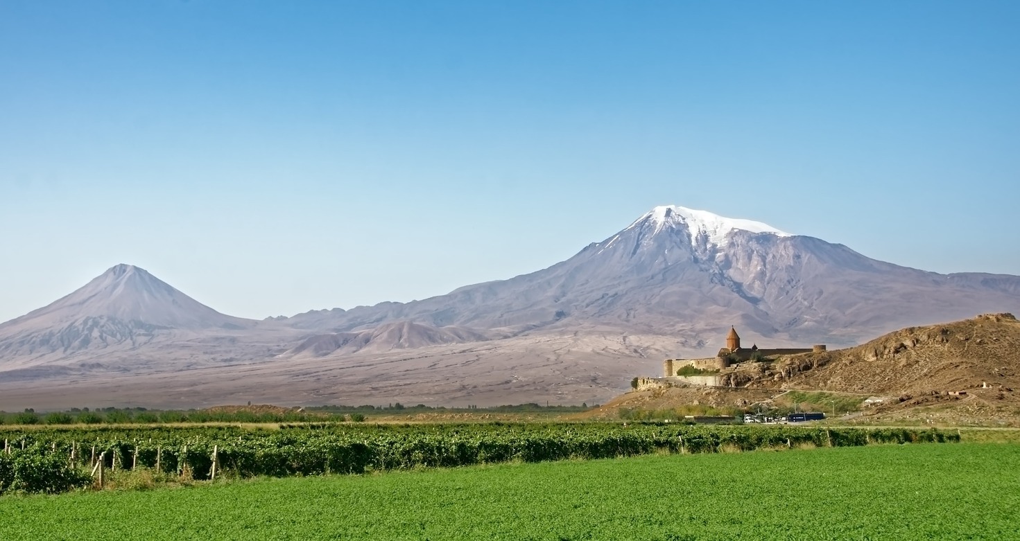
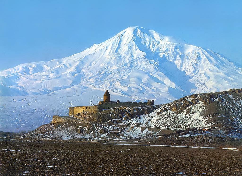
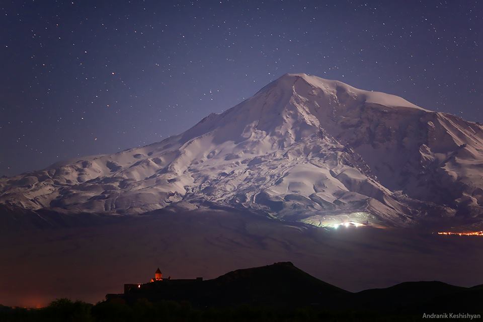
View of Ararat from Khor Virap, Armenia

View of Ararat from Iğdır, Turkey

from Doğubeyazıt

from Iğdır

from Nakhchivan
| Mount Ararat | |
|---|---|
 Little Ararat (left) and Greater Ararat (right); View from Yerevan, Armenia |
|
| Highest point | |
| Elevation | 5,137 m (16,854 ft) See Elevation section |
| Prominence | 3,611 m (11,847 ft) [2] Ranked 48th |
| Isolation | 379 kilometres (235 mi) |
| Parent peak | Mount Damavand[1] |
| Listing | Country high point Ultra Volcanic Seven Second Summits |
| Coordinates | 39°42.113′N 44°17.899′ECoordinates: 39°42.113′N 44°17.899′E |
| Geography | |
 |
|
| Location | Iğdır Province (65%)[3] and Ağrı Province (35%), Turkey[a] |
| Parent range | Armenian Highlands |
| Geology | |
| Mountain type | Stratovolcano |
| Last eruption | 1840[5] |
| Climbing | |
| First ascent | 9 October [O.S. 27 September] 1829 Friedrich Parrot, Khachatur Abovian, two Russian soldiers, two Armenian villagers |
